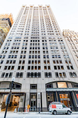
Online or onsite, instructor-led live Geographic Information System (GIS) training courses demonstrate through interactive hands-on practice how to use a GIS to capture, store, manipulate, analyze, manage, and present spatial or geographic data.
GIS training is available as "online live training" or "onsite live training". Online live training (aka "remote live training") is carried out by way of an interactive, remote desktop. Onsite live GIS training can be carried out locally on customer premises in Massachusetts or in NobleProg corporate training centers in Massachusetts.
NobleProg -- Your Local Training Provider
MA, Boston - Federal Street
101 Federal Street Suite 1900, Boston, united states, 02110
The office in Boston's Federal Street is a recently renovated office complex set in the heart of the financial district, just one block from Congress Street. Based on the 16th and 19th floors, the office offers spectacular views of the city. Finance and tourism are some of the prime businesses in the state capital, which is the largest city in New England. With its many colleges and universities, Boston is also regarded an international center of higher education, with students contributing more than $4billion to the economy annually. It has a strong reputation for medicine, biotechnology and research. It is ranked in the top 20 of global financial centers and number one for innovation. Boston also has an historic seaport which supports tourism, industry and fishing.
MA, Burlington - District Avenue
1500 District Avenue, Burlington, united states, 01803
Venue is conveniently located in the center of the Burlington business district ,directly accessible to I-95 and the MBTA bus line and within walking distance to the Burlington Mall, restaurants and shops.
This instructor-led, live training in Massachusetts (online or onsite) is aimed at beginner-level to advanced-level GIS professionals and analysts who wish to learn how to effectively use ArcGIS for data visualization, spatial analysis, and geospatial project management.
By the end of this training, participants will be able to:
Navigate and utilize ArcGIS tools for geospatial data management.
Create and customize maps with layers and attributes.
Perform advanced spatial analysis and geoprocessing tasks.
This instructor-led, live training in Massachusetts (online or onsite) is aimed at advanced-level GIS professionals who wish to use ArcGIS Pro to enhance their spatial analysis capabilities, conduct comprehensive geostatistical analysis, and apply advanced 3D modeling techniques for more effective decision-making and problem-solving in real-world scenarios.
By the end of this training, participants will be able to:
Develop advanced skills in spatial analysis techniques using ArcGIS Pro.
Utilize Python scripting for automation and complex data processing.
Apply spatial modeling for problem-solving in real-world scenarios.
Conduct geostatistical analysis for advanced data interpretation.
Integrate external data sources and leverage 3D spatial data analysis.
This instructor-led, live training in Massachusetts (online or onsite) is aimed at beginner-level IT support personnel who wish to provide robust support for ArcGIS Enterprise, addressing any anomalies or failures effectively.
By the end of this training, participants will be able to:
Understand the architecture and components of ArcGIS Enterprise.
Learn to install, configure, and manage ArcGIS Enterprise.
Gain skills in troubleshooting and resolving common issues.
Develop proficiency in monitoring and maintaining ArcGIS Enterprise environments.
Master the techniques for backup, recovery, and performance optimization.
This instructor-led, live training in Massachusetts (online or onsite) is aimed at beginner-level professionals who wish to learn the fundamental concepts and tools of ArcGIS.
By the end of this training, participants will be able to:
Understand the basic concepts of GIS and spatial data.
This instructor-led, live training in Massachusetts (online or onsite) is aimed at beginner-level earth sciences and engineering professionals who wish to use Python for geospatial analysis in both ArcGIS and QGIS environments.
By the end of this training, participants will be able to:
Learn Python syntax and control structures for executing geospatial tasks efficiently.
Use Pandas, Numpy, and Matplotlib for data analysis and visualization in GIS.
Manipulate and analyze vector data with Geopandas, Arcpy, and PyQGIS libraries.
Automate geospatial processes and workflows using Python scripting in ArcGIS and QGIS.
Develop custom Python-based geoprocessing tools for ArcGIS and QGIS to streamline tasks.
This instructor-led, live training in Massachusetts (online or onsite) is aimed at intermediate-level environmental scientists and archaeologists who wish to learn how to use ArcMap in ArcGIS for collecting, organizing, managing, and analyzing geographic information.
By the end of this training, participants will be able to:
Understand the fundamentals of ArcMap and ArcGIS.
Collect, organize, manage, and analyze geographic information on the social and archaeological elements.
This instructor-led, live training in Massachusetts (online or onsite) is aimed at intermediate-level geographers who wish to deepen their expertise in spatial analysis, data management, and GIS applications.
By the end of this training, participants will be able to:
Apply advanced spatial analysis techniques to solve complex geographical problems.
Manage large spatial databases and perform data quality control.
Create dynamic and interactive maps and visualizations for various applications.
Utilize programming and automation to streamline GIS workflows.
A geographic information system (GIS) is a system designed to capture, store, manipulate, analyze, manage, and present spatial or geographic data. The acronym GIS is sometimes used for geographic information science (GIScience) to refer to the academic discipline that studies geographic information systems and is a large domain within the broader academic discipline of geoinformatics.
The use of Python with GIS has substantially increased over the last two decades, particularly with the introduction of Python 2.0 series in 2000, which included many new programming features that made the language much easier to deploy. Since that time, Python has not only been utilized within commercial GIS such as products by Esri but also open source platforms, including as part of QGIS and GRASS. In fact, Python today is by far the most widely used language by GIS users and programmers.
This program covers the usage of Python and its advance libraries like geopandas, pysal, bokeh and osmnx to implement your own GIS features. The program also covers introductory modules around ArcGIS API, and QGIS toolboox.
This instructor-led, live training in Massachusetts (online or onsite) is aimed at field ecologists and conservation managers who wish to create data spatial projects in ArcGIS.
By the end of this training, participants will be able to:
Output spatial data as visualizations.
Conduct geostatics on actual data.
Implement spatial data analysis, data processing, and mapping with ArcGIS.
This instructor-led, live training in Massachusetts (online or onsite) is aimed at GIS analysts who wish to automate repetitive tasks in GIS processes.
By the end of this training, participants will be able to:
Build GIS applications using Python and ArcGIS tools.
Develop with the ArcGIS package ArcPy, using Python.
Apply the ArcGIS modules for map automation using object classes in Python.
This instructor-led, live training in Massachusetts (online or onsite) is aimed at developers who wish to enhance their website or web application by adding geo-location functionality through Google Maps.
By the end of this training, participants will be able to:
Embed a map into a new or existing website or web application.
Display live data that synchs with current location.
A geographic information system (GIS) is a system designed to capture, store, manipulate, analyze, manage, and present spatial or geographic data. The acronym GIS is sometimes used for geographic information science (GIScience) to refer to the academic discipline that studies geographic information systems and is a large domain within the broader academic discipline of geoinformatics.
QGIS functions as geographic information system (GIS) software, allowing users to analyze and edit spatial information, in addition to composing and exporting graphical maps. QGIS supports both raster and vector layers; vector data is stored as either point, line, or polygon features. Multiple formats of raster images are supported, and the software can georeference images. To summarize it allows the users to Create, edit, visualise, analyse and publish geospatial information on Windows, Mac, Linux, BSD.
This program, in its first phase, introduces the QGIS interface for general usage. In the second phase, we introduce PyQGIS - the python libraries of QGIS that allows the integration of GIS functionalities in your python code or your python application, so that you may even create your own Python Plugin around a particular GIS functionality.
Read more...
Last Updated:
Testimonials (4)
Hands-on examples allowed us to get an actual feel for how the program works. Good explanations and integration of theoretical concepts and how they relate to practical applications.
Ian - Archeoworks Inc.
Course - ArcGIS Fundamentals
All the topics which he covered including examples. And also explained how they are helpful in our daily job.
madduri madduri - Boskalis Singapore Pte Ltd
Course - QGIS for Geographic Information System
I really enjoyed the training. I found all modules to be applicable to problems that I am trying to solve at work. The integration of the training with jupyter notebooks was really impressive.
Mark Firmin - Environment and Climate Change Canada
Course - Python for Geographic Information System (GIS)
The thing I liked the most about the training was the organization and the location
Hamid Tuama - Ability with Innovation General Contracting (DMCC Branch)
Online GIS training in Massachusetts, GIS (Geographic Information System) training courses in Massachusetts, Weekend GIS (Geographic Information System) courses in Massachusetts, Evening GIS (Geographic Information System) training in Massachusetts, GIS (Geographic Information System) instructor-led in Massachusetts, GIS one on one training in Massachusetts, GIS instructor-led in Massachusetts, GIS private courses in Massachusetts, GIS (Geographic Information System) coaching in Massachusetts, GIS trainer in Massachusetts, Online GIS (Geographic Information System) training in Massachusetts, Geographic Information System classes in Massachusetts, Evening GIS courses in Massachusetts, GIS (Geographic Information System) instructor in Massachusetts, GIS (Geographic Information System) on-site in Massachusetts, GIS (Geographic Information System) boot camp in Massachusetts, Weekend GIS training in Massachusetts